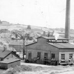
Maps showing potential for soil contamination issued for Wisconsin’s lead-zinc mining district
Maps showing the aftermath of lead and zinc mining in Southwest Wisconsin became available in early October. The maps build on digitized information about mine shafts, open-pit mines, smelters, abandoned rail lines and other features from the 150-year history of mining for lead and zinc in Green, Lafayette, Grant and Iowa counties.
Read More...