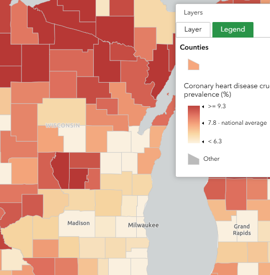
CDC PLACES
The data in the PLACES interactive tool is model generated by the Centers for Disease Control and Prevention (CDC) from various data sources. The map displays a comprehensive list of health related data from the county level down to the Census Tract level. This data includes health outcomes, disability, risk behaviors, and non-medical factors–among others. Places datasets can be downloaded from the PLACES data portal. This tool also links to Census profiles which contain additional information about the geographies of interest.
User expertise rating:
Beginner. Users can select from seven health-related topic areas along the top menu. The seven topic areas are broken into subtopics in the top menu.
Sample questions:
Where are the clusters of adults who lack health insurance or report no routine checkups in the past year? Which Census Tracts show the highest concentrations of adults reporting poor mental health for 14 or more days, and how does this data correlate with areas reporting high levels of physical health distress?