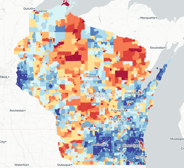
The Neighborhood Atlas
The Neighborhood Atlas, featuring the Area Deprivation Index, ranks census blocks based on socioeconomic disadvantage by aggregating 17 indicators related to income, education, employment, and housing quality. The Atlas can be a resource for precisely tailoring programs for areas where high levels of disadvantage may intersect with other needs. The Atlas translates complex American Community Survey Census data into a visual spatial resource for addressing social determinants of health and economic stability at a granular scale.
User expertise rating:
Beginner. This resource presents data in an easily navigated web map. Video guidance and other documentation are available.
Sample questions:
Which census blocks in a given county rank in the 9th or 10th decile for deprivation, indicating a need for targeted health programs? Where does a high level of disadvantage correspond with a low level of broadband access, indicating that in-person rather than virtual events might better serve the community?