Supply Chain Infrastructure Map
This resource shows production by county of specialty crops in categories such as fruits, tree nuts, novel oilseeds, and small grains, and the infrastructure needed to move crops from fields to consumers.
Read More...
This resource shows production by county of specialty crops in categories such as fruits, tree nuts, novel oilseeds, and small grains, and the infrastructure needed to move crops from fields to consumers.
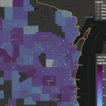
Read More...![Screenshot from the Map the Impact [of immigration] tool](https://fyi.extension.wisc.edu/programdevelopment/files/2026/01/MapTheImpact-150x150.png)
This census data visualization tool from the American Immigration Council centers on the economic impact of immigrants as found in ACS data. Topics include immigrant population share, taxes paid, spending power, number of entrepreneurs, and eligible voters.
Read More...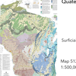
This resource from the Wisconsin Geologic and Natural History Survey conveniently gathers a large number of maps and spatial resources in one place. Click on the map to find resources by geographic area or browse by topic.
Read More...
The Net Migration tool from the UW Applied Population Lab allows users to access a migration profile for each Wisconsin County for the decade starting in 2010.
Read More...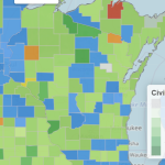
Leveraging IRS data and information scraped from organization websites, this resource from Johns Hopkins University illustrates the landscape of civic opportunity by county.
Read More...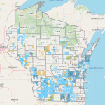
This list of web map applications from the WI Department of Agriculture, Trade, and Consumer Protection provides access to data on agricultural land-use designations and regulatory boundaries, allowing for highly localized technical assistance.
Read More...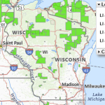
The USDA Food Access Research Atlas and associated mapping tools provide county-level data identifying low-access areas by measuring the number of various types of food stores or markets by county and showing access indicators for different populations.
Read More...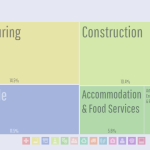
DataUSA is a public-private partnership leveraging U.S. Census and other public data using a flexible dashboard generator for geographies including state, county, and municipality, and Tribal area. Topics include employment, industry, education, income, housing, transportation, poverty, and health.
Read More...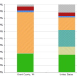
Headwaters Economics is a nonprofit research group focusing on community development and land management. Offered here are a number of tools designed to assess various types of risk at the county or community level.
Read More...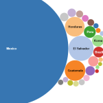
The Migration Data Hub provides comprehensive profiles and interactive maps detailing the demographics, geographic distribution, and socioeconomic characteristics of immigrant populations mostly at the state level, but some data is available at the county, and local levels.
Read More...