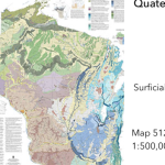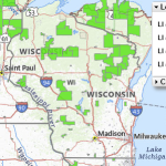
CropScape
The CropScape portal interfaces with the USDA National Agricultural Statistics Service (NASS) Cropland Data Layer (CDL). CropScape uses remote sensing, ground truthing, and special algorithms to provide a comprehensive 30 x 30 meter census of land cover.
Read More...
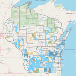
![Screenshot from the Map the Impact [of immigration] tool](https://fyi.extension.wisc.edu/programdevelopment/files/2026/01/MapTheImpact-150x150.png)