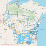
This list of web map applications from the WI Department of Agriculture, Trade, and Consumer Protection provides access to data on agricultural land-use designations and regulatory boundaries, allowing for highly localized technical assistance.
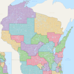
The LTSB is the state’s authoritative source of legislative district information, and information about state representatives. Products available for download include district maps, election data, and redistricting data.
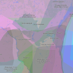
Native Land Digital is an evolving and Indigenous-led educational tool designed to support Indigenous self-determination, visibility, and connection.
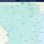
This resource aggregates local parcel datasets into a statewide file. The data includes typical attributes such as owner name, address, school district, assessed values, and property tax.
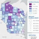
APL’s Wisconsin Food Security Project provides data to help identify food security strengths, risk factors, and gaps via socio-economic factors.
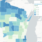
APL’s Wisconsin Risk and Reach Project assesses potential gaps between publicly funded programs and community risks especially as they relate to children and families.