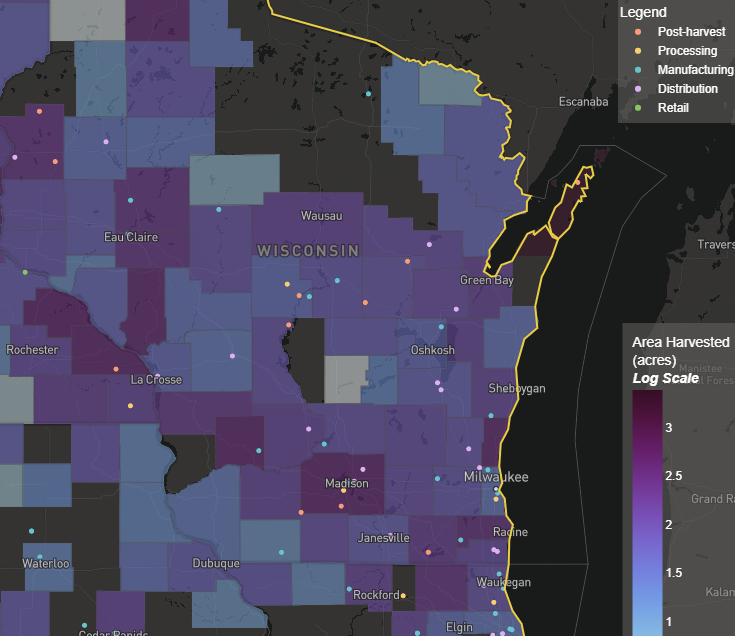
Supply Chain Infrastructure Map
This resource shows production by county of specialty crops in categories such as fruits, tree nuts, novel oilseeds, and small grains, and the infrastructure needed to move crops from fields to consumers. The goal of this tool is to help farmers find processors, help investors find gaps where new facilities are needed, and help buyers identify regional sourcing options. Production data comes from USDA NASS; asset data comes from a private logistics and business data provider.
User expertise rating:
Beginner. Account registration and login required. Users with the necessary agriculture and supply chain knowledge will have no trouble navigating this interactive resource.
Sample questions:
In regions showing high production of oats or rye, where are the nearest cleaning and milling facilities, and what is the processing radius local farmers must travel to reach them? Which counties have high specialty crop production but limited local processing where developing new businesses like commercial kitchens, mills, or juicing facilities would be valuable?