Wisco County Migration Trends
The Net Migration tool from the UW Applied Population Lab allows users to access a migration profile for each Wisconsin County for the decade starting in 2010.
Read More...
The Net Migration tool from the UW Applied Population Lab allows users to access a migration profile for each Wisconsin County for the decade starting in 2010.
Read More...
The USDA Food Access Research Atlas and associated mapping tools provide county-level data identifying low-access areas by measuring the number of various types of food stores or markets by county and showing access indicators for different populations.
Read More...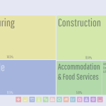
DataUSA is a public-private partnership leveraging U.S. Census and other public data using a flexible dashboard generator for geographies including state, county, and municipality, and Tribal area. Topics include employment, industry, education, income, housing, transportation, poverty, and health.
Read More...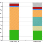
Headwaters Economics is a nonprofit research group focusing on community development and land management. Offered here are a number of tools designed to assess various types of risk at the county or community level.
Read More...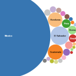
The Migration Data Hub provides comprehensive profiles and interactive maps detailing the demographics, geographic distribution, and socioeconomic characteristics of immigrant populations mostly at the state level, but some data is available at the county, and local levels.
Read More...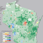
The UW-Madison Applied Population Lab offers a tremendous breadth of interactive demographic and socio-economic tools, analyses, and reports. Some of these are detailed in this Data Inventory, but APL provides many more than can be listed here.
Read More...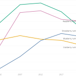
The Census of Agriculture Viewer, developed by UW-Extension, can be used to explore data from the USDA Census of Agriculture between 2022 and 2002. The data is organized into 4 tabs: Farms, Demographics, Crops and practices, and Livestock.
Read More...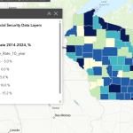
This resource, available only to logged-in wisc.edu users, provides a comprehensive suite of financial well-being indicators for Wisconsin, integrating data on assets, debt, employment, housing, income, and poverty from diverse sources.
Read More...
In this document the UW-Extension Office of Access, Inclusion, and Compliance (OAIC) consolidates dozens of disparate federal and state data sources into a single, organized directory for rapid assessment.
Read More...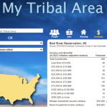
Finding data collected from Tribal Nation geographies can be challenging. This resource allows users to view statistics from the most current ACS aggregated and tabulated specifically to match the boundaries of the designated Tribal Geographies in Wisconsin.
Read More...