Matthew Call, Director of Communications and Stakeholder Engagement, mcall@wisc.edu
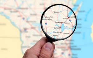 Food security is more important than ever, and now a newly updated, free online tool offers enhanced visualization and data resources on food security and its foundations in Wisconsin. The updated Wisconsin Food Security Project website, foodsecurity.wisc.edu, provides tools to see and understand local food security rates and the factors that influence food security, including demographic breakdowns, economic indicators, use of food assistance programs, and food access across the state. Users can customize these tools to create maps and profiles of counties, school districts, and municipalities around the state.
Many people are struggling to afford the food they need during the COVID-19 public health emergency and its economic fallout. Recent estimates suggest food insecurity, in Wisconsin and nationwide, has doubled in the early months of the pandemic, creating new urgency around the issue for many communities.
“Across Wisconsin and the nation, many households have lost some or all of their regular income. Others have lost access to usual sources of food, such as school meals and senior meal programs. The Wisconsin Food Security Project provides state and local information about food security and its underlying foundations in Wisconsin. By providing systematic data that can be combined with local knowledge and insight, we hope to empower planners, policymakers, and local stakeholders to identify strengths, risk factors, and gaps in their communities,” said Judi Bartfeld, Food Security Research and Policy Specialist for the UW-Madison Division of Extension and Meta Schroeder Beckner Outreach Professor for the UW-Madison School of Human Ecology.
The Wisconsin Food Security Project is an interactive data and mapping portal featuring county and subcounty data related to food security and the foundations of food security in Wisconsin. It is a collaboration between Bartfeld and the UW-Madison Applied Population Lab. It’s intended to support stakeholder groups in identifying long-standing as well as newly emerging risk factors that impact food security in their communities. It also supports comparisons of how risk factors vary around the state. It includes information on:
- Food security: Estimates of the county food insecurity rate during 2018 and projections for the food insecurity rate in 2020 based on expected pandemic-related increases in unemployment and poverty (data courtesy of Feeding America’s Map the Meal Gap project)
- Demographics: Data to explore how demographic risk factors for food insecurity vary around the state
- Economic well-being: Indicators of poverty, median income, unemployment, housing costs, and rent-burdened households before the onset of COVID-19 and unemployment rates several months after the pandemic began
- Food assistance programs: Information about the use of federal food programs, including FoodShare and school meals, before COVID-19 and information on FoodShare use several months after the pandemic began
- Food access: Information on the number and kinds of retail food outlets around the state
- Health and disability: A variety of indicators related to health, disability, and insurance
You can access these data in a range of ways:
- Customizable maps that can be saved and shared
- Customizable profiles of counties, school districts, and municipalities around the state
- Scatterplots to see how variables are related
- Downloading data for offline use
More information about UW-Madison Division of Extension can be found at extension.wisc.edu
More information about UW-Madison School of Human Ecology can be found at sohe.wisc.edu
More information about Applied Population Laboratory can be found at apl.wisc.edu