The Fox Demo Farms Network works in the Lower Fox River Watershed…
So, what is a watershed?
A watershed is an area of land that drains water, sediment, and dissolved materials to a common outlet at some point along a stream channel. We all live within a watershed and although they may vary in size and location, it is important to understand that what we do on the land directly impacts the health of our local waterways.
Lower Fox River Watershed:
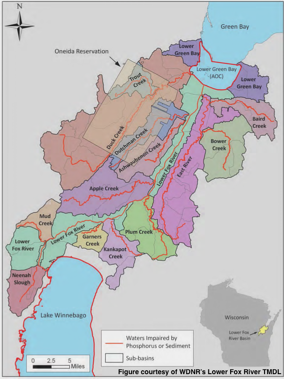
The Fox Demo Farms Network is located in the Lower Fox River Watershed, which starts at the outlet of Lake Winnebago and flows northeast for 39 miles where it empties into Lower Green Bay.
As shown on the map, there are several tributaries that flow in the Lower Fox River. A tributary is a smaller river or creek that flows into a larger river or body of water and in this case, the Lower Fox River and bay of Green Bay.
Activities that take place on the land, directly impact the water quality. The streams highlighted in red indicate “impaired” waters, which means that the water does not meet the water quality standards set by the Clean Water Act, due to high levels of phosphorus and/or sediment loading.